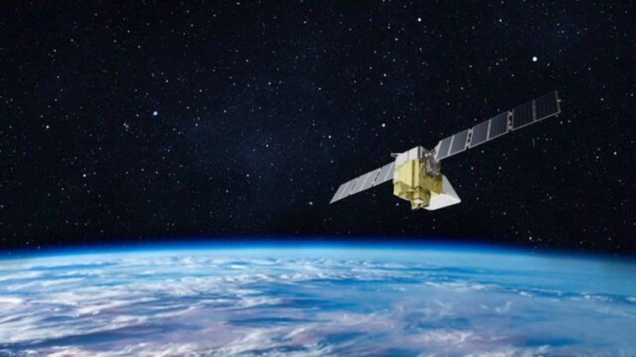
Earth observation satellites (EOS) play a key role in monitoring and protecting the environment, helping to manage natural resources, respond to global humanitarian crises, and address emergencies. Using these satellites, critical data is collected for agriculture, environmental monitoring, mineral exploration, and urban planning.
These tasks are carried out by hundreds of satellites grouped in constellations, each with different operating principles. Optical satellites capture Earth in the visible spectrum, like ordinary cameras, but with very high resolution. These are the kinds of images we see every time we open Google Maps. Infrared sensors detect thermal radiation, helping to monitor ocean temperatures, wildfires, and heat leaks in cities. Radar satellites use radio waves that penetrate clouds and even the ground, allowing them to “see” terrain and structures hidden beneath the surface. Hyperspectral satellites analyze the Earth’s surface across multiple spectra to, for example, determine the composition of soil and vegetation.
Here’s a look at how the commercial segment of satellite remote sensing originated, the current state of the industry, and where it is headed.
The evolution of commercial satellite sensing
The first Earth observation satellite was TIROS-1. NASA launched it into low Earth orbit on April 1, 1960, as an experiment to understand how useful satellites could be for studying Earth. Even then, they were seen as important sources of information for accurate weather forecasting.

Source: NOAA / wikipedia.org
The commercial Earth observation satellite market, however, only really began to develop nearly 40 years after TIROS-1. On September 24, 1999, Space Imaging, which later became part of DigitalGlobe (now Maxar Technologies), launched the first commercial EOS satellite, IKONOS-1. Its uniqueness at the time lay in its unprecedented photo resolution of 1 and 4 meters. The quality of these images was comparable to that provided by military satellites. Images from IKONOS officially became available for sale on January 1, 2000. Over the course of the project, which lasted until the end of March 2015, IKONOS captured nearly 600,000 images, covering an area of 400 million square kilometers.
In the wake of IKONOS-1, the commercial Earth observation market began to grow rapidly. In 2001, the QuickBird satellite was launched, providing images with a resolution of 0.61 meters, significantly improving the quality of available data. In the following years, GeoEye and DigitalGlobe, which acquired GeoEye in 2013, launched satellites with resolutions of up to 0.5 meters, expanding the capabilities of commercial Earth remote sensing. By 2020, the global commercial Earth observation data market had reached $1.6 billion. At that time, the primary customers were governments and defense agencies. However, other applications emerged as well, and demand for data from such satellites grew as a result of the development of analytical processing.

Source: satimagingcorp.com
Survival of the fittest
In 2021, the National Geospatial-Intelligence Agency (NGA) held the Commercial Imagery Olympics, which resulted in an in-depth analysis of the key players in the commercial satellite systems market. At that time, the first place in the medal tally was shared between American and Chinese satellites, each of which earned three awards. A similar competition was held in 2024, but this time, three independent organizations ranked among the top three commercial remote sensing systems using an updated methodology, while maintaining the previous ranking system. The winners were chosen in 11 categories. The Chinese systems emerged as the leaders, with five medals. Meanwhile, four medals went to American systems, and one medal each was awarded to Finland and South Korea.
It is worth noting that many commercial satellite systems developed in the United States and other countries are used not only for civilian purposes but also for government purposes. Companies in this sector provide data and analytical services to both the open market and government agencies. At the same time, more advanced technologies are available to government clients, which are not offered in the commercial sector. However, these capabilities were not considered in the ranking.

Source: Center for Strategic and International Studies
At the time, the leader in the electro-optical (EO) systems segment was the SuperView Neo-1 satellite launched by China in 2022. It captures images with a resolution of 0.3 m with a high imaging frequency. However, by the time the next report is published, it is quite likely that the United States will take the lead with the new WorldView Legion satellite constellation from Maxar Technologies. Some satellites in this constellation were already launched in 2024.
In the operational image update category, the gold medal went to the Chinese Jilin-1 constellation, which has more than 100 active satellites. For video imaging, the top spot was taken by the American satellite system, SkySat, thanks to its high frame rate and exposure time.
Synthetic Aperture Radar (SAR) systems were also evaluated across various bands. In the X-band SAR, the leader was Umbra SAR (USA), ahead of Capella Space (also USA) and Finland’s ICEYE. In the C-band SAR, the gold medal went to China, while the silver went to the Canadian RADARSAT-2.
In the spectral systems segment, two winners were also chosen. In the multispectral range, China’s SuperView Neo-3 won the gold, while in hyperspectral imaging, Orbital Sidekick (USA), with its GHOSt satellite constellation, claimed the top spot, beating the Indian company Pixxel.
As for infrared (IR) systems, the leader in the short-wave infrared (SWIR) category was the WorldView-3 satellite constellation (USA). In the mid-wave infrared (MWIR) category, the leader was South Korea’s KOMPSAT-3A (2015), while in the long-wave infrared (LWIR) category, China again dominated. However, competitive infrared systems are also being actively developed in the USA, specifically by Albedo Space and Muon Space, which could be launched as early as 2025.
The satellite Earth sensing market in numbers
In 2024, the global satellite market was valued at $17.94 billion. According to MarketsandMarkets, it is projected to reach $35.95 billion by 2030, growing at an annual rate of 12.3% during the forecast period. In 2024, 3,154 satellites are expected to be launched worldwide. Projections suggest that by 2030, this number will increase to 5,048 units, with a compound annual growth rate (CAGR) of 8.2%.
Separately, the global Earth observation market, as reported by Novaspace, was valued at $5 billion in 2023 and could grow to $8 billion by 2033. This growth is expected for various reasons, including an increase in defense contracts and a growing interest in Earth monitoring capabilities due to the availability of high-resolution imagery.

Source: DigitalGlobe
As of 2023, the main player in the market was the United States, which accounted for 44% of the revenue from commercial Earth observation satellite systems. Europe followed, with a share of 22%. However, the situation is currently changing due to the rapid development of the Asian market. According to Novaspace’s forecasts, by 2033, Asia will account for 23% of the global market, driven by increased investment in space infrastructure and high demand from countries in South and Southeast Asia, as well as the Middle East. For example, India is focusing on this sector to secure a place in the global commercialization of space race. In Canada, which plans to invest over 1 billion Canadian dollars in satellite systems over the next 15 years, the focus is on improving effectiveness in preventing wildfires and other environmental crises.
Source: financialexpress.com
Growth Drivers and Constraints
One of the key factors driving the growth of the satellite observation market is the high quality of imaging. High-resolution images obtained from space, combined with hyperspectral analysis, open up possibilities that were previously unavailable. For example, satellites not only help determine the concentration of pollutants in the atmosphere but also track the spread of infectious diseases such as cholera, typhoid, and dengue fever by analyzing human activity and changes in vegetation. Additionally, satellite imagery helps detect illegal fishing and track the movement of ships, even when their transponders are turned off.

Source: NASA
Another important driver in the Earth observation satellite market has been the development of small satellite constellations. Constellations of satellites working simultaneously provide valuable and up-to-date information through frequent data updates and are used for monitoring things like urban infrastructure, transportation, and logistics. Other applications include the optimization of maritime routes based on weather conditions and glacier movements.
The demand for satellite data is also increasing due to advancements in artificial intelligence and machine learning technologies. These technologies allow not only for analyzing vast amounts of satellite data but also for automatically detecting anomalies, such as predicting rockfalls or identifying underground cavities that pose a threat to ground infrastructure.
Along with market drivers, however, there are also several limiting factors. The main one is the high costs associated with launching and maintaining satellite constellations, as well as the need for qualified specialists, which hinders the emergence of new players in the market. A partial solution here could be the use of cheaper small satellites (weighing from 1 to 500 kg). However, this does not change the fact that the industry is heavily regulated, limiting access to high-resolution data for commercial use. Additionally, the growing number of satellites increases the volume of space debris, raising the risks of collisions and damage to orbiting spacecraft.

Source: NASA
At the same time, alternative Earth observation technologies are emerging, including aerial unmanned devices, ground sensors, and high-altitude balloons. While their capabilities are currently significantly inferior to satellites, that situation may change in the future. Companies like Google and World View Enterprises, as well as the startup Zero 2 Infinity, have begun investing in the development of high-altitude balloons. Drones, meanwhile, are already actively involved in archaeological and climate research, traffic monitoring, and other tasks.
Applications
Commercial Earth observation satellites continuously provide valuable data to various industries. We’ve already mentioned the monitoring of natural resources and ecosystems, exploration and planning, ensuring security, and environmental control. But there are many more practical applications of satellite observation data. In the case of natural disasters, satellite data helps not only to warn of threats but also to combat the consequences: for example, quickly assessing the scale of destruction and planning rescue operations. Archaeological reconnaissance includes the search for not only mineral deposits but also ancient settlements. This is how previously unknown pyramids and settlements were discovered in Egypt.
The images themselves, which are obtained from space, are not the key to solving the above problems. Often, this is preceded by deep analytics that allows the extraction of accurate and valuable information from those images. This is what the company, EOS Data Analytics, founded by Ukrainian investor, entrepreneur, and philanthropist Max Polyakov, does. EOS Data Analytics supplies and analyzes geospatial data, ensuring the sustainable development of agriculture and forestry worldwide. It uses its own space infrastructure, a constellation of seven optical satellites with synthetic aperture radar (SAR) payloads, capable of capturing any point on our planet and monitoring spatial data around the clock.
The African agricultural company Complete Farmer has also integrated satellite image analytics from EOSDA Crop Monitoring (one of EOS Data Analytics’ tools) into its network of farm partners across Africa. This allows farmers to make decisions based on accurate data, optimize workflows, and increase yields. The world’s largest tomato processor, Morning Star, integrated ground sensor data with satellite image analysis to improve irrigation and increase tomato yields in California. The Saamaka community in Suriname (South America) uses satellite data from EOS Data Analytics to protect its forests from illegal logging by monitoring changes in forest cover and preventing environmental crimes.

Source: eos.com
However, this is just the beginning: satellite remote sensing technologies are rapidly evolving and opening up new possibilities. Satellites are becoming more compact and precise, while AI and machine learning accelerate data processing. Significant developments are constantly happening in this field, shaping the future of remote monitoring.
The latest developments in the industry
Today, EOS system developers are increasingly focusing on hyperspectral imaging, digital modeling of the planet, and the integration of artificial intelligence for data processing. The European Commission and the European Space Agency (ESA) recently signed a contract with the Finnish company Kuva Space, making it the sole supplier of hyperspectral data for the Copernicus program. As part of this agreement, the company will receive $5.3 million to create a constellation of 100 CubeSat satellites capable of capturing Earth images in different spectral ranges. This will allow for detailed monitoring of climate changes, soil conditions, and other natural processes.
In the United States, the National Geospatial-Intelligence Agency (NGA) announced the launch of the new Luno program, aimed at expanding the use of commercial satellite imagery. The agency will now purchase more images from private companies, which will enhance monitoring and reconnaissance capabilities. At the same time, Lockheed Martin and NVIDIA have begun work on a digital “Earth twin” project that will analyze satellite data flows in real time. This tool combines meteorological observations with artificial intelligence algorithms to forecast weather phenomena and track global environmental changes.
An example of how Lockheed Martin and NVIDIA model a forest fire on an accurate digital twin of Earth using artificial intelligence:
Meanwhile, China continues to strengthen its position in the commercial satellite sector. Recently, two new SuperView Neo-1 satellites were launched into orbit, becoming part of the expanding Siwei remote sensing system. Currently, it includes nine satellites, but in the coming years it is expected to expand to 28. Chinese developers claim that their devices have the highest resolution among all commercial satellites in the country.
Botswana, for its part, launched its first BOTSAT-1, an Earth remote sensing satellite developed in partnership with Dragonfly Aerospace, a South African company specializing in optical systems and Earth observation satellites. In addition, Dragonfly Aerospace will provide optics for three more satellites from the Australian company LatConnect 60, which is supported by the Australian Space Agency and the government, funding a project to develop high-resolution SWIRSAT satellites.
Iran also announced plans to launch three satellites in the coming months: Kowsar, Tolo-3 (Sunrise-3), and Zafar-2 (Victory-2). These satellites are intended for monitoring natural resources and environmental conditions.
The commercial Earth remote sensing market thus continues to grow. In the future, we will see even more active use of technologies like SAR radar, hyperspectral imaging, and space-based “edge computing,” in which satellite data is processed on-site and later sent to Earth. Meanwhile, we observe that large businesses are increasingly integrating satellite data into their business models, and investments in this sector remain high.