
The new geopolitical landscape of the mid-2020s has been marked by the United States’s gradual disengagement from Europe’s security architecture, a shift that has extended beyond the continent itself and into near-Earth space. A striking example of this growing strategic divide emerged during the escalation in the Persian Gulf and Iran’s effective closure of the Strait of Hormuz in 2026. At the request of the Trump administration, the largest U.S. commercial satellite imagery providers unilaterally shut down the open market and suspended the sale of imagery covering Iranian territory and the Gulf to third parties, including America’s European allies.
As a result, international energy traders, major insurance companies, shipping firms, and European government agencies, all of which had spent years building their analytical capabilities around U.S. satellite data providers, suddenly found themselves facing a significant intelligence blind spot. The episode forced Europe’s space industry to respond rapidly, accelerating efforts to fill the military space intelligence gap by developing and expanding its own satellite reconnaissance capabilities.
Past collaboration
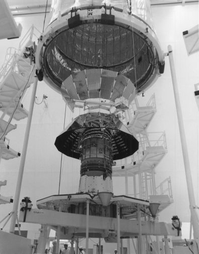
Historically, the West’s military space intelligence architecture rested on a transatlantic partnership in which U.S. government systems played the central role. The U.S. National Geospatial-Intelligence Agency (NGA) and the National Reconnaissance Office (NRO) operated highly classified Keyhole (KH-11) optical reconnaissance satellites and Lacrosse radar satellites, sharing intelligence with European NATO allies under a network of tightly controlled bilateral agreements established during the Cold War.
Although European nations developed their own government-operated systems, such as France’s Helios optical satellites and Italy’s COSMO-SkyMed radar constellation, they nevertheless remained strategically dependent on Washington’s global coverage and superior intelligence analysis capabilities.
Source: en.wikipedia.org
Throughout the 2000s and 2010s, this intelligence partnership gradually shifted toward the commercial sector, with the emergence of private satellite operators in the United States. Companies such as DigitalGlobe and GeoEye (later merged into Maxar Technologies) launched spacecraft like IKONOS, QuickBird, and the WorldView series. This allowed European security agencies and commercial organizations to legally purchase high-resolution satellite imagery without relying on complex, classified government-to-government intelligence channels.
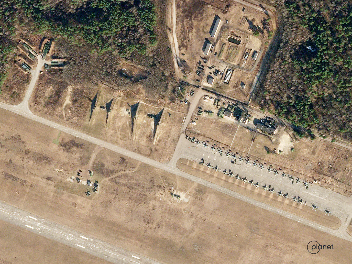
The turning point that fundamentally transformed the role of the private space sector came with Russia’s full-scale invasion of Ukraine in February 2022. It was then that Western governments and independent analytical organizations realized that commercial satellite constellations operated by U.S. and European companies could effectively serve as real-time military reconnaissance assets. This shift effectively removed the veil of secrecy from a significant amount of operational intelligence, allowing the world to witness the movement of Russian forces through imagery captured by satellites that had, until then, been used primarily for civilian purposes.
Source: www.washingtonpost.com, Planet Labs PBC
The primary driver of optical intelligence during the early stages of the Russo-Ukrainian War was the American company Maxar Technologies, operating its constellation of WorldView-1, WorldView-2, WorldView-3, and GeoEye-1 satellites. These spacecraft were capable of delivering imagery with a spatial resolution of up to 30 cm per pixel, capturing kilometer-long columns of Russian armored vehicles advancing toward Kyiv, the siege of Mariupol, fortifications, and enemy military bases. In effect, Maxar became the West’s principal open-source provider for verifying battlefield developments, serving both the international community and the Ukrainian military.
At the same time, Planet Labs launched an unprecedented monitoring campaign using its PlanetScope megaconstellation, consisting of hundreds of CubeSat-class satellites from the Dove and SuperDove series. Although these satellites offer significantly lower resolution (around 3 meters per pixel), their sheer numbers enable near-daily imaging of the entire battlefield. For higher-resolution intelligence, Planet also relied on its larger SkySat satellites, capable of sub-meter imagery with a high revisit rate.
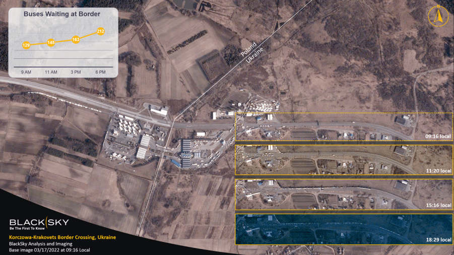
Another critical pillar of the American commercial satellite intelligence ecosystem was BlackSky. Its constellation of low-Earth orbit Gen-2 optical satellites, later enhanced by the more advanced Gen-3, was specifically designed to minimize latency between image requests and data delivery. As a result, Ukraine’s Defense Forces were able to receive updated intelligence on frontline developments within hours, and in some cases even minutes, after a satellite passed over the area of interest, allowing Ukrainian commanders to track enemy tactical movements with remarkable speed and precision.
Source: breakingdefense.com
Optical satellites, however, have one major limitation: they are ineffective in dense cloud cover and at night, a critical disadvantage on the Eastern European battlefield. This is where satellites equipped with Synthetic Aperture Radar (SAR) moved to the forefront. The American company Capella Space, whose fleet includes SAR satellites, supplied high-resolution radar imagery capable of seeing through clouds and darkness, making it possible to detect Russian pontoon bridges, military equipment, and troop deployments regardless of weather or lighting conditions.
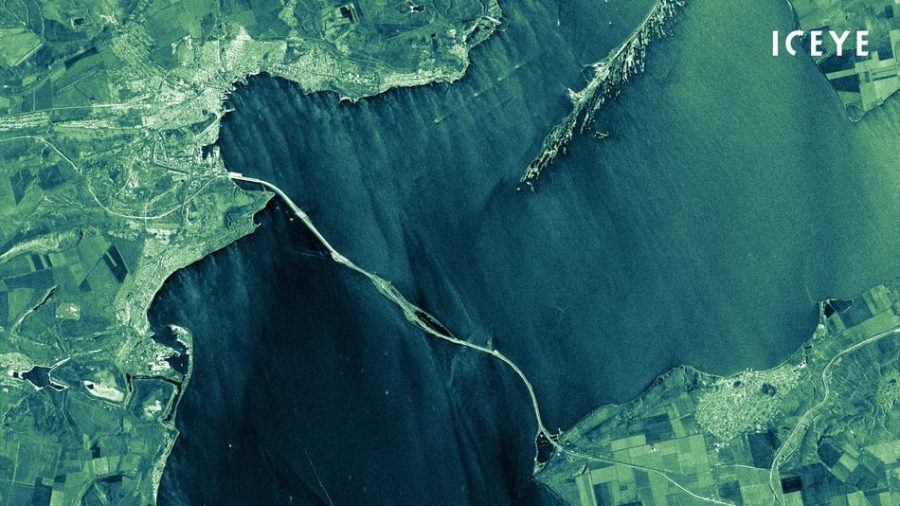
At the same time, 2022 became the first major wartime test for Europe’s private space sector, led by the Finnish company ICEYE. Operating one of the world’s largest commercial SAR satellite constellations, ICEYE demonstrated exceptional flexibility that significantly strengthened the space-based intelligence capabilities of Ukraine and its Western allies. European radar technology proved every bit as capable as its American counterparts, providing reliable, all-weather surveillance of critical infrastructure and military activity.
Source: iceye.com
A historic milestone for Ukraine’s military intelligence came in August 2022, when the Serhiy Prytula Charity Foundation, through EOS Data Analytics and funded by public donations, purchased full access to one of ICEYE’s SAR satellites, along with a contract granting Ukraine access to the company’s entire satellite constellation database for use by the Main Directorate of Intelligence (HUR) of the Ministry of Defense. This gave Ukraine the sovereign ability to independently prioritize imaging targets without relying on political approval from Washington or Brussels. Within the first few months alone, intelligence gathered through this satellite contributed to the detection and destruction of thousands of pieces of Russian military equipment in the temporarily occupied territories.
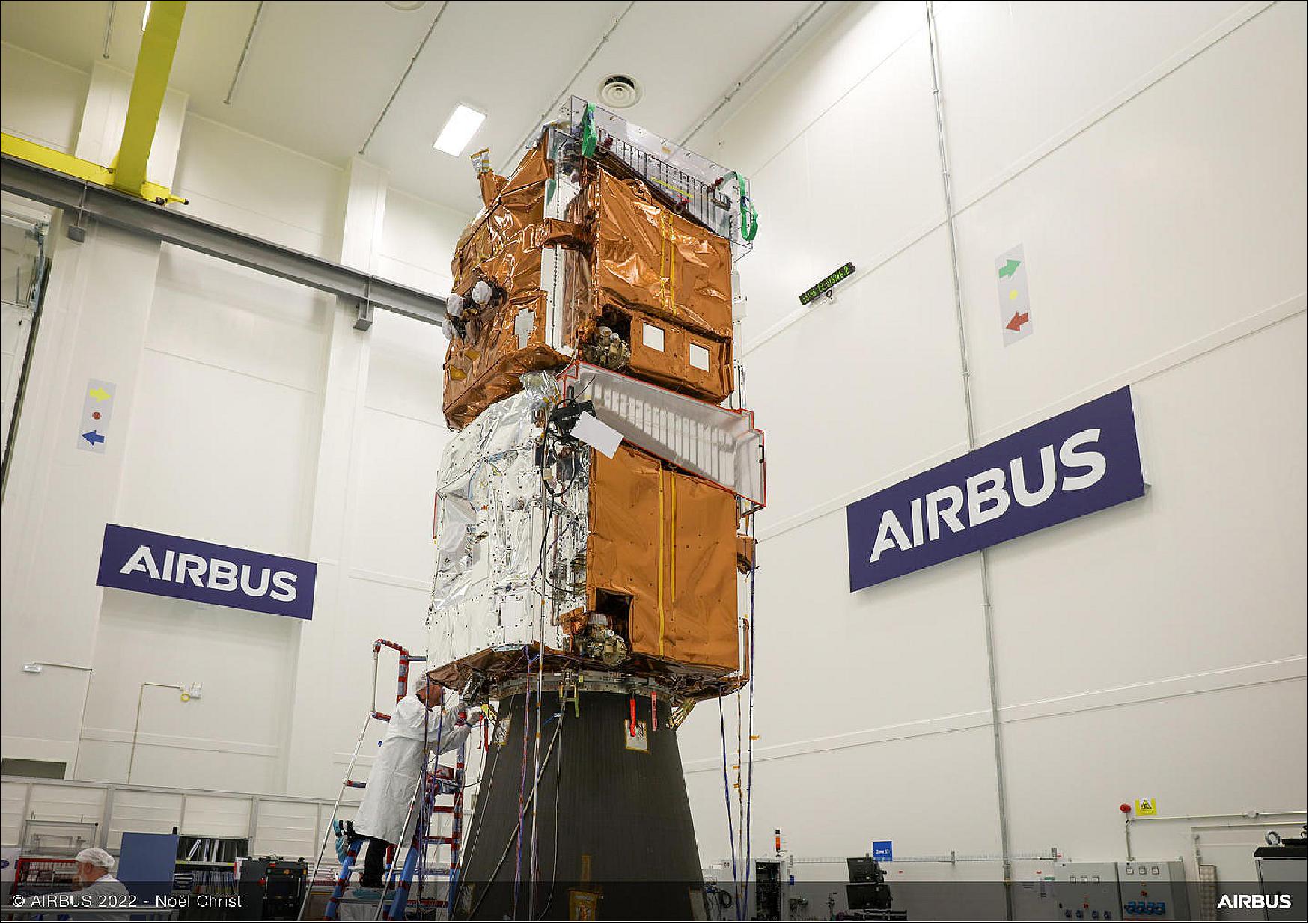
Over the course of four and a half years of full-scale war, however, ICEYE was far from the only company to strengthen Ukraine’s space-based intelligence capabilities. European aerospace giant Airbus Defence and Space has continued providing high-resolution optical imagery from its Pléiades and Pléiades Neo satellite constellations. These systems enable detailed three-dimensional terrain analysis and help assess damage to fortification networks. The combined use of data from Maxar, Planet, BlackSky, ICEYE, and Airbus created a powerful intelligence ecosystem that, for a time, helped offset Russia’s numerical advantage in heavy weapons and military equipment by significantly enhancing Ukraine’s space reconnaissance capabilities.
Source: eoportal.org
The EU Satellite Centre (SatCen), located in the Spanish town of Torrejón de Ardoz, has become an institutional element of European support for Ukraine. The organization provides Ukrainian government agencies with geospatial intelligence (GEOINT) based on satellite data. On March 23, 2022, the Council of the European Union adopted a decision authorizing the transfer to Ukraine of classified information produced and analyzed by SatCen. This decision established the legal basis for sharing satellite intelligence between the EU and Ukraine. These materials are currently used to monitor combat zones, assess the impact of strikes, and enhance situational awareness in areas of active hostilities.
SatCen also serves as the operator of the security component of the Copernicus programme, using Sentinel satellite data together with commercial imagery to produce geospatial intelligence products. In particular, these satellite observation data help assess the extent of damage to Ukrainian infrastructure caused by Russian missile and drone attacks. The outputs of the European programme have been used for crisis response and to support EU external operations, including in Ukraine, which in 2025 signed an agreement to participate in components of the EU Space Programme, including accession to the Copernicus programme.
The war in Ukraine has clearly demonstrated that commercial satellite operators have become an integral element of modern warfare. The transatlantic model of commercial satellite intelligence functioned effectively, but it was built on the assumption that the interests of the U.S. government and American private companies would always align with those of their European allies. That assumption, as well as the perception of an unshakable American security umbrella, began to unravel following the profound political changes that took place in the United States after the November 2024 elections.
Current challenges
Donald Trump’s return to the White House was accompanied by calls for a sweeping reassessment of U.S. foreign policy and the principles that underpin NATO’s system of collective security. The new administration sharply criticized America’s European allies, accusing them of chronically underfunding their own defense budgets while relying on U.S. taxpayers for their security. This policy shift quickly extended into the space sector, initiating a gradual U.S. withdrawal from the longstanding practice of automatically supporting Europe’s security needs through American satellite intelligence capabilities.
Under pressure from the White House, major U.S. commercial satellite operators redirected their operational capacity toward the requirements of the Pentagon and the National Reconnaissance Office (NRO). Commercial contracts with European customers were deprioritized, while access to a significant portion of operational imagery was restricted or suspended under new export control regulations. Washington made it clear that American orbital assets were instruments of U.S. national policy, not a shared intelligence resource for all NATO allies.
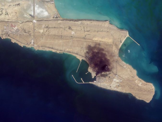
The crisis reached its peak during the war with Iran in 2026. At the direct request of the Trump administration, the largest U.S. commercial satellite imagery providers temporarily and unilaterally restricted the public distribution of imagery covering the conflict zone around the Strait of Hormuz. The stated objective was to conceal military movements from potential adversaries and limit publicly available intelligence. However, the restrictions also affected America’s European partners, leaving them without access to imagery they had long relied upon.
Source: gpb.org, Planet Labs PBC
The consequences of this decision were highly disruptive for the global satellite intelligence market. European energy companies, shipping operators, and insurers that depended on U.S. satellite imagery to assess risks to tanker traffic suddenly faced interruptions in access to commercial data. Even European government agencies willing to pay premium prices for urgent imagery of Iranian ports were turned away by American providers. A new reality had emerged, one that had previously seemed purely theoretical: a near-total intelligence blackout imposed by Europe’s closest ally.
Europe’s response was swift and pragmatic. Recognizing the strategic implications, both public and private European satellite operators moved rapidly to fill the commercial and military intelligence vacuum. For Europe’s Earth observation sector, the crisis created a unique opportunity to capture a share of the global geospatial intelligence market that American providers had effectively abandoned.
The Finnish company ICEYE, which was mentioned previously, took the lead in replacing American radar imagery in conflict zones. Because its headquarters and primary manufacturing facilities are located in Helsinki, the company operates exclusively under European export regulations and is not subject to directives from the White House. During the 2026 crisis, ICEYE experienced an unprecedented surge in commercial demand, continuously supplying SAR imagery of the Strait of Hormuz to international insurers and government customers.
Airbus Defence and Space also responded quickly by reprioritizing the imaging schedule of its Pléiades Neo constellation to meet European demand. With a spatial resolution of up to 30 centimeters per pixel, the satellites were tasked extensively with monitoring logistics hubs across the Middle East, demonstrating that European optical reconnaissance could compete with Maxar in both image quality and delivery speed. As a result, numerous European commercial customers began terminating long-standing contracts with U.S. providers in favor of Airbus and other European satellite operators.

Source: gpb.org, Airbus Defence and Space
New European players also joined the effort to eliminate the intelligence gap, including the French company Prométhée. Specializing in constellations of small reconnaissance satellites designed for rapid data refresh, Prométhée offers customers flexible tools for tactical monitoring. Its digital platform also integrates data from multiple European sources, providing geospatial analytics in near real time.
Another important factor in stabilizing the market was the deployment of Italy’s national IRIDE satellite constellation. The system produced its first high-quality test imagery in March 2025, and over the following year, the constellation expanded with additional satellites. Combining optical, SAR, and hyperspectral sensors, IRIDE has positioned itself as a powerful dual-use capability that EU governments increasingly employ for both civilian and military security missions across the Mediterranean region and the Middle East.
Source: db.satnogs.org
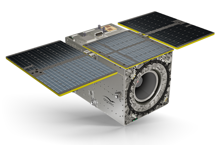
Building on the experience of IRIDE, the European market recognized the need to strengthen its capabilities through new contracts for specialized dual-use satellite systems. European governments and the European Space Agency (ESA) began placing greater emphasis on developing sovereign capabilities in thermal infrared, hyperspectral, and radar-based Earth observation. Unlike previous programs focused primarily on climate research and critical infrastructure monitoring, these new initiatives were also designed to address security needs, from detecting thermal anomalies and monitoring logistics corridors to tracking military activity in conflict zones.
At the same time, several emerging European NewSpace companies were officially incorporated into the Copernicus Contributing Missions ecosystem. These included Finland’s ICEYE with its SAR satellites, Germany’s constellr and OroraTech, which are equipped with advanced thermal imaging systems, France’s Prométhée, Spain’s SATLANTIS, and Bulgaria’s EnduroSat. Their inclusion granted these companies access to long-term contracts with ESA and the European Commission, accelerating the development of an independent European space-based military intelligence sector.
The transatlantic geopolitical divide of recent years has thus fundamentally reshaped the global space services market. By the end of 2026, it had become clear, even to the most optimistic observers, that Washington’s attempt to restrict satellite imagery of Iran had produced the opposite effect. Within just a few months, the European Union had begun building a robust customer base for its own satellite industry, one that was no longer dependent on American satellite operators.
The future of European military space intelligence
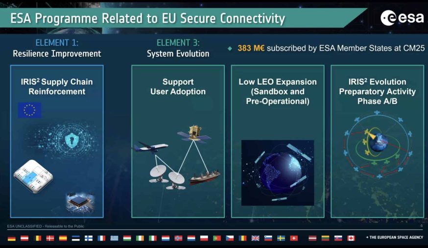
It is becoming increasingly clear that the future of European space-based military intelligence lies in the deep integration of the private satellite sector into large-scale multinational programs. Recognizing the risks of excessive dependence on American technology, the European Union has shifted from theoretical discussions to the practical implementation of its own defense space architecture. The centerpiece of this strategy is the accelerated deployment of the IRIS² multi-orbit satellite constellation, designed to provide Europe with secure broadband communications and integrated sensors, including capabilities for military surveillance.
The already mentioned SatCen occupies a central place in the new architecture. Previously, the satellite centre used commercial data from Maxar, Airbus, and other international providers, and also cooperated with NATO partner structures. Now, within the approved roadmap for development up to 2030, SatCen is being transformed into a major analytical hub that will directly manage the prioritisation of tasks for European private satellite constellations, partly funded through the European Defence Fund (EDF).
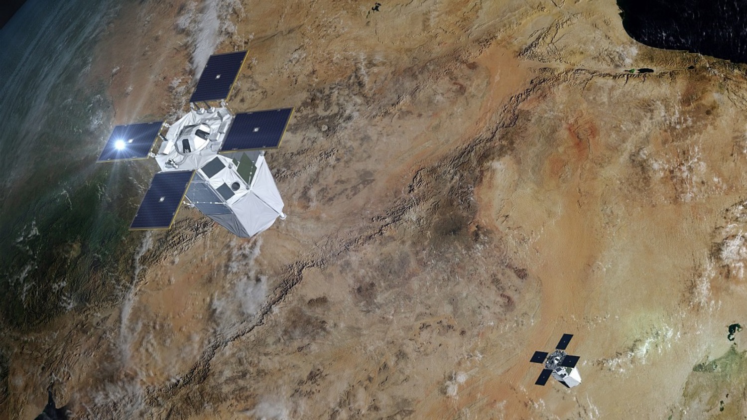
At the national level, Europe’s leading space powers are simultaneously expanding their own sovereign capabilities to complement the broader European military space intelligence network. France continues to develop its Composante Spatiale Optique (CSO) optical reconnaissance system, while Germany has deployed the latest-generation SARah radar reconnaissance satellites (unfortunately, two of the three spacecraft experienced technical anomalies shortly after launch and failed to deploy their radar antennas). Meanwhile, Spain continues to operate and upgrade its PAZ radar satellite while advancing the PAZ-2 program, which is intended to significantly expand the country’s national SAR reconnaissance capabilities.
Source: thalesaleniaspace.com
All of these government-operated assets are ultimately expected to be integrated into a unified data-sharing network alongside the commercial satellite systems of operators such as ICEYE, Airbus Defence and Space, and other private providers.
Strengths and weaknesses
To offset its growing separation from the United States, Europe’s new strategic roadmap calls not merely for launching more satellites, but for fundamentally rethinking how orbital data are processed. The defining trend is the tight convergence of satellite communications and Earth observation systems, ultimately enabling remote sensing data to be transmitted via secure inter-satellite links with minimal latency.
Source: spaceintelreport.com
At the end of May 2026, the European Commission formally proposed legislation to redistribute mobile satellite spectrum in support of European satellite operators. The new initiative would reserve scarce 2 GHz frequencies for European satellites serving both government and commercial purposes. One third of the available scarce spectrum would be reserved for the 290 satellites of IRIS², while the remaining two thirds would be allocated among commercial operators. Priority would also be given to new European satellite operators entering the market.
The European decision is already creating serious problems for U.S. operators, including Viasat and EchoStar, whose current European spectrum licenses expire in May 2027. Although foreign players may still compete for parts of the remaining spectrum, this protectionist approach significantly limits their ability to plan long-term and scale communication services for vehicles and mobile devices across Europe.
The new regulatory policy has further strained already tense relations between the EU and the United States, drawing sharp opposition from leaders of the American space industry. At the same time, not everyone in the EU is enthusiastic about this protectionist approach. The proposal has already sparked internal debate: while some officials insist on strict limits on foreign access to scarce spectrum, supporters of a more flexible approach want to leave at least some opening for the commercial participation of major U.S. operators such as Starlink, Viasat, and EchoStar.
A key component of this roadmap is the use of computer models and artificial intelligence algorithms for automated data analysis. Increasingly, large volumes of geospatial information from European satellites are undergoing initial automated processing using AI and computer vision systems. These data are automatically overlaid onto three-dimensional digital terrain models to simulate dynamic processes, from tracking logistics flows and verifying the scale of infrastructure destruction to predicting enemy troop movements based on changes in terrain and thermal signatures.
This approach also enables the creation of highly effective predictive systems. By integrating commercial shipping-monitoring data, radio-frequency analysis from constellations such as Unseenlabs, and high-resolution optical imagery, European analysts gain a unique ability to forecast crises in maritime areas and combat zones before they fully unfold.
Yet despite the significant progress made by European private satellite monitoring companies in recent years, the sector still faces a number of challenges that slow the development of Europe’s military space capabilities. The gap with the United States is clearly visible in the numbers: the U.S. still operates the world’s largest Earth observation satellite fleet, comprising hundreds of government and commercial spacecraft from operators such as Maxar Technologies, Planet Labs, BlackSky, and others. By contrast, Europe’s monitoring satellite fleet, excluding the United Kingdom, consists of only several dozen government and commercial satellites. As a result, the United States retains a severalfold advantage in reconnaissance satellite numbers, giving it far greater revisit capacity and access to a much larger volume of geospatial data.
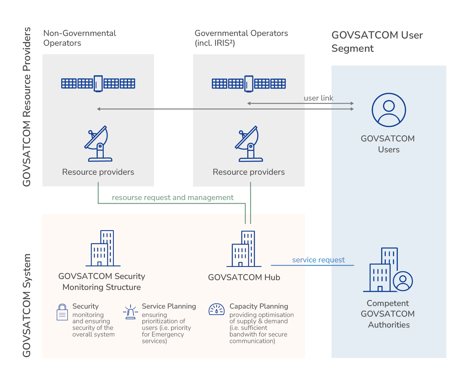
Second, Europe’s military intelligence capabilities still lag significantly behind those of the United States in terms of deployment speed and integration. One of the main problems remains fragmentation: the satellite systems of France, Germany, Italy, Spain, and other countries were developed as national projects, each with its own standards, data-access procedures, and priorities. This complicates the rapid exchange of information among allies and prevents the creation of a unified European military space intelligence system. That is why the European Union is investing in programs such as IRIS² and the GOVSATCOM mechanism, which are intended to bring existing government and commercial space resources into a shared secure architecture. For now, however, these are primarily secure satellite communications systems; a unified vision for a pan-European monitoring constellation dedicated to intelligence needs still does not exist.
Source: euspa.europa.eu
Another major challenge is the limited scale of investment and manufacturing capacity compared with the United States. European operators possess competitive technologies in Earth observation, optical imaging, and synthetic aperture radar (SAR) satellites, but they lag in deployment speed and levels of government funding. Analysts also point out that slow decision-making processes, reliance on multinational consortia, and the lengthy timelines of European space programs are poorly suited to the pace of modern warfare, where new satellite constellations must be deployed within months rather than years.
Despite these challenges, European satellite operators are doing more than simply adapting to the demands of a new geopolitical reality: they are making significant progress. Thanks to their technological leadership in SAR imaging and the rapid growth of the private aerospace sector, Europe is gradually overcoming the effects of American isolationism. If programs such as IRIS² and IRIDE are successfully implemented, and given Russia’s severe technological shortages in access to Western space components and modules, the EU has a realistic opportunity—provided resources are allocated effectively—to establish itself as one of the world’s leading providers of satellite imagery and geospatial intelligence.