Mankind has been observing the climate since ancient times, the word “meteorology” has been with us since the time of Aristotle. Scientists of the late 19th and early 20th centuries were able to put together a general climatic picture, discover the relationship between CO2 and temperature, but still, until the middle of the 20th century, these were local observations and forecasting attempts, without a clear understanding of the entire system.
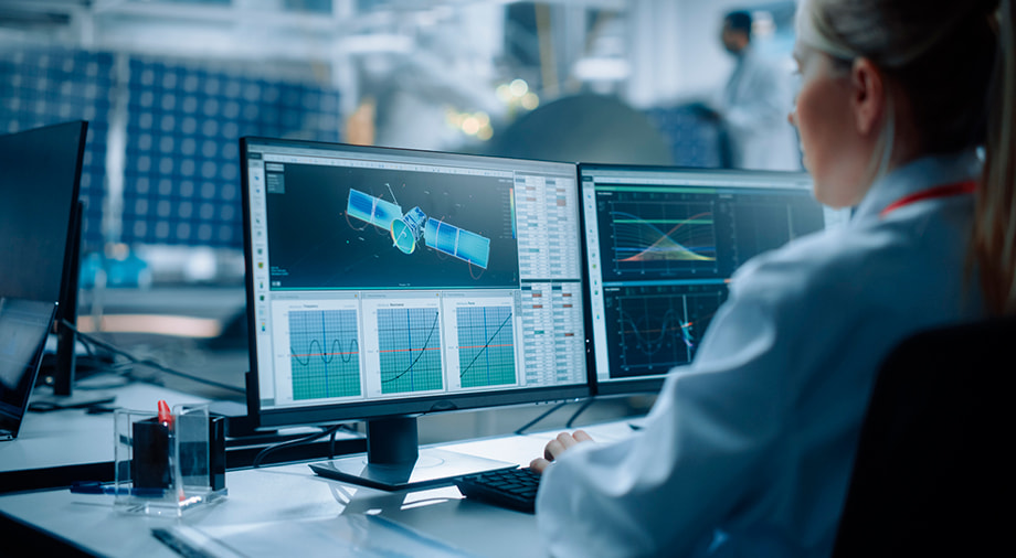
It was only until the advent of satellite technology that meteorologists and ecologists were allowed to see the whole picture and observe the dynamics of climate change on Earth.
In this article, we will look at the satellites which help fight climate change and how they do this, as well as whether it is possible to change the weather from space.
The first steps
Scientists began to think about the fact that satellites can be used to monitor climate, weather, and the ecological situation even before the first launches into space. And the first meteorological satellites entered orbit just a few years after the first orbit flights. In 1959, the United States launched the Vanguard 2 satellite into orbit, which was supposed to track daytime clouds using two telescopes, two optical scanners and transmit data to Earth using two antennas. This attempt cannot be called successful, since the satellite could not collect a sufficient amount of reliable data due to the fact that it received an unsatisfactory orientation of the spin axis when separating from the rocket – in other words, it was not able to take clear pictures. In 1960, NASA launched TIROS-1, widely regarded as the first successful weather satellite.
In the USSR, the first climate spacecraft entered space only by 1967, 10 years after the first orbit flight. But at the same time, the Soviet satellites “Kosmos-144” and “Kosmos-156” formed the first Soviet meteorological satellite system “Meteor”, which eventually included 35 satellites armed with optical, infrared, and actinometric sensors.
Data from meteorological satellites made it possible not only to predict the weather in the near future but also to receive and accumulate data on all changes at all points of the globe. Vital data for environmental scientists and meteorologists.
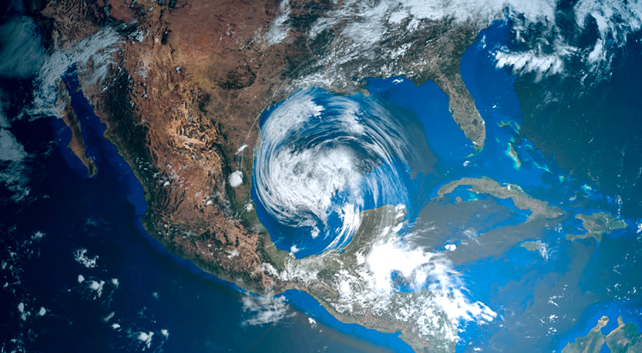
Why satellites are useful
If we talk about climate change and ecology, satellites, from early launches to the present, perform the function of observers, allowing satellites to cover vast territories, continents, and all sides of the Earth where it would be difficult for scientists to reach or where it is impossible to place ground probes.
In addition, thanks to modern technology, satellites are able to look through clouds, through the ice at the poles, and even through the earth’s crust thanks to high-precision infrared cameras and aperture radars. For example, modern satellites can “see” mineral deposits, the state of polar ice at great depths, measure the composition of water, and even look through the walls of buildings.
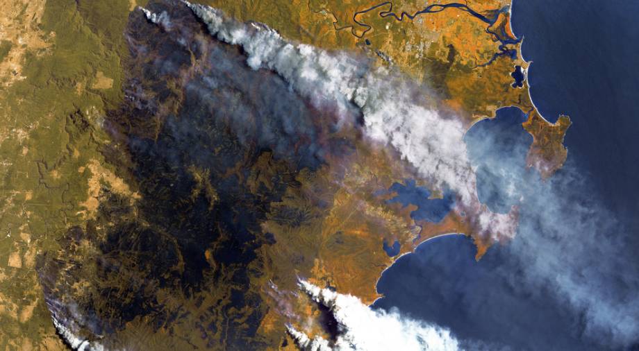
Certain satellites can record not only accurate data in real time but also signs of climate change: melting glaciers, changes in the sea level, the content of gases in the atmosphere, especially CO2.
One key area where satellites have been applied is in the prevention of application of satellites is the prevention of natural disasters, or rather the preparation for them and minimization of damage. Satellites and analysis systems provide early warnings of impending hurricanes, tsunamis, forest fires, and even earthquakes, as well as transmit data on the intensity of the elements and the direction of movement. For example, they are able to register the slightest fluctuations in the water and in a matter of seconds calculate the likely area of damage from a tsunami.
Another advantage of satellite observation is that such systems can almost immediately and see a sudden negative phenomenon anywhere, such as an oil or chemical spill, an incipient forest fire, or a breakaway glacier.
It is difficult to say for sure at what stage the environmental movement would be now without satellites, but satellite technology has definitely helped international organizations in the fight to cleanse the planet. For example, the president of the French space agency CNES, Jean-Yves Le Gall, noted that the observation of the state of the Earth largely depends on satellites. “the COP21 itself would have been impossible without the help of satellites,” he notes.
Present and future plans
Today, NASA controls the majority amount of climate satellites, it is also the National Aeronautics and Space Administration that collects and disseminates most of the data on climate change and the planet’s ecology.
For example, their Terra satellite, launched back in 1999, remains the flagship of the Earth remote sensing space constellation. With the size of a minivan and weighing almost 5 tons, it carries 5 environmental and climate change probes that monitor the atmosphere, ocean, soil, snow, and ice.
Another NASA project is “The Afternoon Constellation”, whose satellites were named A-Train due to the fact that they fly one after another over the same point on the Earth at intervals of several minutes. The main satellite of the “train” is the Orbiting Carbon Observatory-2, launched in 2014.
The European Space Agency (ESA), in partnership with the World Bank, started the Eoworld project in 2011 to help developing countries protect forests, handle urban sprawl, use water resources and manage coastal zones to ensure their economies are resilient to climate change.
In addition, ESA plans to launch 20 satellites by 2030, which will provide data for 20 years. These satellites will become part of the largest Earth monitoring system in the history of space exploration.
The commercial sector of Earth satellite monitoring is also rapidly developing and, according to experts, presently has been valued at around 4.4 billion dollars, and by 2027 this number will grow to 6.3 billion. This perfectly demonstrates the business interest in satellite monitoring, which can help to both make a profit and also control the impact of production on the environment.
For example, EOS Data Analytics monitoring systems are already working with farms around the world, and since 2021 they have launched a forestry monitoring project, the goal of which is to remotely monitor the state of the forest, receive notifications via smartphone or other devices about changes or possible risks, and manage all forest assets in one place, as well as forecast the costs of harvesting, transportation, and storage.
The distant future
Scientists have been conducting experiments for a long time and trying to develop devices that allow them to influence the climate and weather. The first such attempts were made during the Cold War, but they practically did not lead to anything. So far, the most effective method has been chemical, such as spraying silver iodide directly from an airplane into clouds to make it rain. But sending special satellites into orbit, regularly refueling them with chemical cartridges in order to make it rain in a certain area, is impractical and extremely expensive.
Another way of combating the adverse effects of climate change is using a laser to cool a section of the atmosphere. But such an installation requires a constant power supply and by itself is not capable of causing the formation of any significant cloud to be visible from the ground. In the distant future, it is theoretically possible to use such lasers, provided that there are many of them. At the moment, the only feasible condition for such a network of satellites is the power supply, the other technological aspects of this project might be ready in the near future.
Due to technological and financial factors, satellites in the near future will not be able to directly influence the climate and ecology of the planet, but undoubtedly they have already become the “eyes” of scientists and the main source of data on our planet.