In the previous installment of this series, we recounted the history of satellite oceanography: from the first studies of water resources in the mid-1970s aboard the American orbital station Skylab to the deployment of compact, sensitive satellite sensors on the American-French spacecraft TOPEX/Poseidon. The latter commenced the collaboration between NASA and the French National Center for Space Studies (Centre National d’Études Spatiales, or CNES) on the development of a new generation of oceanographic satellites, initiating the world’s longest-running oceanographic research program, one that has been ongoing continuously for over 30 years.
Three iterations of success: the Jason satellite series
After the successful deployment of TOPEX/Poseidon, NASA and CNES started thinking about new oceanographic satellites similar to the one already in orbit. The main purpose of additional satellites was to ensure continuity in monitoring global sea levels. This led to the concept of the Jason satellite series, which would eventually grow into three independent missions.
The primary task of the Jason satellites was to improve the accuracy of global ocean level measurements, and when the first satellite, Jason-1, reached orbit on a Delta II launch vehicle on December 7, 2001, it was the most sensitive oceanographic satellite in the world, with a measurement accuracy of less than 2.5 cm (compared to the 4.2 cm provided by TOPEX/Poseidon).
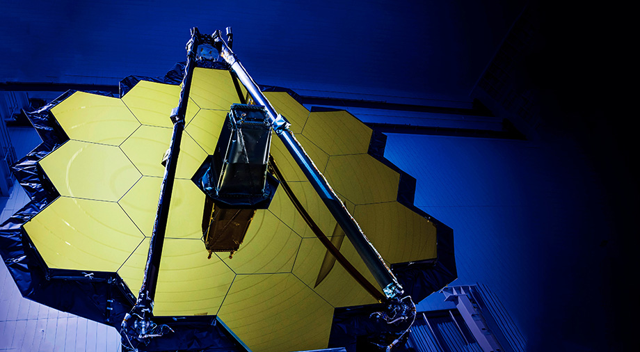
Jason-1 was equipped with five instruments to conduct its research:
- Jason Microwave Radiometer (JMR): a microwave radiometer that corrected for atmospheric water vapor.
- Poseidon-2: an improved dual-frequency radar altimeter (Ku and C bands), providing higher accuracy than Poseidon-1 on TOPEX/Poseidon.
- DORIS: a Doppler system for real-time orbit determination.
- GPSP: a GPS receiver for precise positioning.
- Laser Retroreflector Array (LRA): a laser retroreflector for ground-based satellite calibration.

Source: sealevel.jpl.nasa.gov
The cost of Jason-1 was approximately $135 million. NASA and CNES split this amount unevenly: the Americans contributed over $90 million to the project, while the French provided only $45 million. Additionally, Jason-1 became one of the first oceanographic satellites to involve the U.S. National Oceanic and Atmospheric Administration (NOAA) and the European Organization for the Exploitation of Meteorological Satellites (EUMETSAT).
These agencies joined the mission not as developers, but as the primary users of the data collected by Jason-1. This collaboration significantly improved the accuracy of weather forecasts, allowing them to be based directly on observational data. NOAA’s and EUMETSAT’s involvement elevated Jason-1 from a purely research mission to an operational one, enabling users worldwide to access accurate information on marine weather.
It is important to note that Jason-1 was launched while TOPEX/Poseidon was still active. NASA and CNES deliberately timed this to ensure the continuity of satellite observations. An additional benefit was conducting a joint tandem mission of the two satellites. Jason-1 was placed in the same operational orbit as TOPEX/Poseidon, and, once in orbit, the satellites began a joint tandem mission lasting eight months. TOPEX/Poseidon led the way, with Jason-1 following precisely behind at a distance of roughly 70 seconds. This configuration allowed both satellites to pass over the same ocean regions with only a slight time difference.
This orbital rendezvous was necessary for calibrating and validating Jason-1. Although the satellite had been designed with the most advanced technologies available at the time, its instruments still needed fine-tuning in actual operational conditions. Calibration thus relied on the already verified settings of TOPEX/Poseidon. Flying in tandem allowed the comparison of measurements from both satellites over identical ocean regions with millimeter-level precision. This made it possible to detect and correct any differences in the performance of the instruments on both spacecraft.

Source: wikipedia.org
During the tandem mission, high-quality data on ocean tides were obtained, particularly regarding their dissipation. It turned out that about one-third of the planet’s tidal energy is dissipated not in shallow waters, as previously thought, but in the deep ocean. The joint work of the two satellites also enabled the development of new computer models of the ocean, which in turn played a key role in climate forecasting. After successful calibration in August 2002, Jason-1 stopped following its partner and moved into a separate orbit. TOPEX/Poseidon, meanwhile, continued to operate until October 2005.
In August 2008, the second Jason satellite, named OSTM/Jason-2 (Ocean Surface Topography Mission), was launched. Like its predecessor, it was the product of a collaboration among four leading participants: NASA and CNES acted as the commissioning agencies, while NOAA and EUMETSAT were the main users of the data.
The main contractor for the project was the French company Thales Alenia Space, which had previously worked on Jason-1 for CNES. The aerospace company developed the Proteus satellite bus, which housed all of the systems and research equipment used on OSTM/Jason-2. Thales Alenia Space also created the satellite’s primary instrument, the Poseidon-3 radar altimeter, which represented the next iteration of the altimeters first installed on TOPEX/Poseidon. In addition, the satellite carried an upgraded microwave radiometer (AMR) and updated systems for orbit determination and precise positioning, including DORIS, GPSP, and LRA, which had also been installed on Jason-1.

Source: wikipedia.org
The OSTM/Jason-2 mission mirrored its predecessor, beginning with a cross-calibration phase conducted through a tandem mission with Jason-1. After this, the spacecraft once again separated into different orbits (called an interleaved orbit phase), with Jason-1’s orbit positioned between the main tracks of Jason-2. This configuration allowed the satellites, working together, to cover twice as much area as either could alone, making measurements roughly 150–160 km apart. This methodology enabled a better study of small oceanic eddies and other mesoscale phenomena. Notably, the strategy of using two satellites for mutual validation and expanded coverage became standard practice for subsequent Jason missions, as well as for Sentinel-6.
Shortly after Jason-1 was decommissioned on July 1, 2013, NASA and CNES began developing the third satellite of the series, named Jason-3. Structurally, the new satellite closely resembled Jason-2, differing mainly in the inclusion of an improved model of the radar altimeter, Poseidon-3B.
Several new experimental instruments were also installed on the Proteus satellite bus, including the Light Particle Telescope (LPT) developed by the Japan Aerospace Exploration Agency (JAXA) for measuring the radiation environment around the satellite. Another experimental instrument was the French ChaRacterization and Modeling of ENvironment (CARMEN) device, which studied the effects of space radiation on the high-precision DORIS satellite oscillator. Jason-3 was launched on January 17, 2016. After a six-month tandem mission with Jason-2, the two satellites transitioned to separate orbits, following the pattern of previous missions.

Source: en.wikipedia.org
Currently, Jason-3 continues its observations in orbit on a 10-day cycle. It became the final satellite of the Jason series, summarizing decades of productive NASA–CNES collaboration in studying global ocean levels and other sensitive parameters. The culmination of this partnership was the launch of a new oceanographic satellite, Sentinel-6A Michael Freilich, on November 21, 2020.
SAR capabilities and satellite oceanography
Although the Sentinel-6A Michael Freilich was conceptually similar to Jason-3 and was designed to perform the same tasks, technologically it was a completely different satellite. First of all, France’s CNES, which had participated in the development of the Jason satellites, ceded its role to the European Space Agency (ESA). The collective European space effort ensured faster development for the new project, since the combined budgets of all European spacefaring nations significantly exceeded the budget of France alone.
Secondly, the primary contractor changed. Instead of Thales Alenia Space, the lead developer was now the Airbus Defense and Space aerospace corporation, specifically its German division. The primary distinction, however, was the new radar altimeter, Poseidon-4, which could operate in synthetic aperture radar (SAR) mode.
The first SAR satellite used for oceanographic purposes (Seasat-1, which was discussed in the first installment of this article) was launched in 1978. In the 47 years since then, SAR technology has made a significant qualitative leap, allowing new types of sensors to deliver ultra-high-resolution imagery that is independent of weather conditions or day-night cycles. This new sensor proved especially effective in monitoring waters in coastal areas, where previous satellites had struggled due to excessive signal noise (a kind of data “contamination”) coming from land.

Source: user.eumetsat.int
The AMR-C microwave radiometer, used by Sentinel-6A to measure water vapor content in the Earth’s atmosphere, was also upgraded. The data it provides is used to correct altimeter signal delays that occur as the signal passes through the atmosphere. Thanks to the correction provided by AMR-C, the satellite can achieve millimeter-level measurement accuracy.
Another innovation is the Global Navigation Satellite System — Radio Occultation (GNSS-RO), which uses signals from GPS and Galileo to measure temperature and humidity profiles in the Earth’s atmosphere. This helps improve the meteorological forecasts provided by the satellite. The precise orbital positioning of Sentinel-6A Michael Freilich is maintained by Precise Orbit Determination (POD) instruments. These include additional GNSS receivers, the DORIS system, and the Laser Retroreflector Array (LRA), which was previously used on the Jason series of oceanographic satellites. Together, these instruments enable Sentinel-6A to maintain its designated orbital trajectory with high accuracy.
Furthermore, Sentinel-6A is a key component of the Copernicus program, whose main goal is to provide free and open access to high-precision global data for environmental monitoring and management. This makes the program crucial for supporting European policy in climate protection and emergency response to natural and man-made disasters.
Sentinel-6A Michael Freilich will not be operating alone for much longer. A twin satellite is expected to join it sometime in 2026 and will eventually replace the primary satellite when its mission concludes. Sentinel-6A’s planned operational lifetime is 5.5 years, but, as with previous missions, it will likely be extended through 2030. Even if Sentinel-6A were to fail prematurely due to a technical anomaly or software issue, the continuity of oceanographic observations is ensured, since Jason-3, which is less precise but still active, remains in orbit.
New monitoring methodologies and innovations
The operational principles behind the Jason and Sentinel-6 satellites are quite similar. However, not all satellites focused on monitoring and studying the oceans and their geoid work in the same way. A good example of an alternative approach is the Surface Water and Ocean Topography (SWOT) mission, which was launched in December 2022.
SWOT is the result of collaboration among four space agencies: NASA, CNES, the Canadian Space Agency (CSA), and the United Kingdom Space Agency (UKSA). The distinguishing feature of SWOT, compared to projects like Jason and Sentinel-6, is its innovative KaRIn interferometer. Unlike single altimeters like Poseidon, which measure only directly beneath the satellite’s flight path, SWOT’s interferometer has two active radars, located at each end of a 10-meter boom. This allows the radars to amplify radar pulses that reflect off the water surface at a certain angle.
Instead of a single measurement, the KaRIn radars receive two reflected signals simultaneously, which are then superimposed (interfered). By analyzing the phase difference between these signals, scientists can create a highly detailed two-dimensional topographic map of the water surface. The satellite is also equipped with a conventional Nadir radar altimeter pointing directly downward beneath the satellite. Some SWOT visualizations combine data from both KaRIn and Nadir to produce an integrated view of the radar observations.

Image courtesy of K. Widman for NASA-JPL.
Source: researchgate.net
KaRIn technology allows measurements of areas up to 120 km wide in a single satellite pass. This is hundreds of times larger than what is achievable with conventional single-direction radar altimeters. Such an approach is especially important for satellite oceanography, since it enables coverage of oceans and rivers faster than existing systems like Jason and Sentinel-6 can provide.
The total cost of the SWOT mission is estimated at approximately $1.2 billion, with the majority of funding coming from NASA. Data from the satellite are processed by two leading institutions: NASA’s Jet Propulsion Laboratory (JPL) and CNES’s Laboratory for Space Studies and Oceanography (LEGOS). Through data analysis and archiving, personnel create the most detailed maps of ocean currents and hydrological systems worldwide. In just three years, SWOT has already provided hundreds of gigabytes of data. Some of this data has paved the way for a better understanding of the interactions between fresh and salt water and their impact on the climate.

Source: aviso.altimetry.fr
NASA develops satellite oceanography projects in collaboration with NOAA. In 2032, the oceanic research organization plans to launch a series of Geostationary Extended Observations (GeoXO) satellites, which are intended to replace the current GOES-R meteorological satellites. While the geostationary GOES-R satellites are not full-fledged oceanographic satellites, since their instruments focus on measuring sea surface temperature and wind speed, the new GeoXO satellites will significantly expand the oceanographic component. To achieve this, the satellite series will be equipped with innovative instruments that greatly enhance the scope of ocean research:
- Ocean Color Instrument (OCX) — the first instrument of its kind to be placed in geostationary orbit (GEO). Its main task will be to monitor the color of the world’s oceans, with observations occurring every 15 minutes. The data collected will help track chlorophyll concentration, a key indicator of phytoplankton. Such research is critical for understanding the global ocean ecosystem. The OCX will also collect information on suspended particles (a measure of water quality) and dissolved organic matter, helping scientists monitor ocean pollution. It will accurately detect oil spills and harmful algal blooms, as well as provide general data on the productivity of different ocean regions.
- Imager and Sounder — although the previous GOES-R series was equipped with similar instruments, the GeoXO satellites will carry significantly upgraded versions. These will provide more precise data on atmospheric moisture and precipitation intensity, crucial for forecasting floods and droughts.
Placement in geostationary orbit (over 35,000 km), far above where satellites like Sentinel-6 and Jason operate, will allow the GeoXO constellation to provide continuous monitoring of coastal waters, estuaries, and large lakes in the Western Hemisphere, aiding water resource management and rapid response to emergencies.
Each satellite in the future GeoXO constellation will focus on monitoring a specific portion of the Western Hemisphere to ensure full and continuous coverage. GeoXO East (set to reach orbit in 2032) will monitor weather events such as hurricanes over the eastern United States and the Atlantic Ocean. GeoXO West will focus on weather systems, wildfires, and ocean phenomena in the western United States and the Pacific Ocean. GeoXO Central will provide supplementary data on air and climate conditions for central regions, enhancing overall observational coverage.

Source: meteorologicaltechnologyinternational.com
The GeoXO series is planned to consist of three primary satellites operating in different orbital planes and is expected to be some of the longest-serving meteorological satellites in NOAA’s fleet. They are currently projected to remain in orbit for approximately 22 years, from 2032 to 2055, with the possibility of extending their operational lifetime.
The main contractor for the GeoXO project is Lockheed Martin. NASA, on behalf of NOAA, has signed a record-setting $2.27 billion contract with the company to develop the project. A separate clause in the contract stipulates that, in addition to building the three planned satellites, the company may construct up to four more units at NOAA’s request, potentially expanding the total GeoXO monitoring fleet to seven spacecraft.
Some private initiatives and organizations are also focusing on tackling ocean pollution. For example, the non-profit organization The Ocean Cleanup uses satellite data to model the movement of debris, enabling them to efficiently manage their water cleanup operations. Their models take into account ocean currents, winds, and other tracking data to predict the trajectory of plastic waste.

Source: atccrimescenecleanup.com
Most of the current innovations in satellite oceanography are linked to the active implementation of artificial intelligence (AI) models, which provide new methods for processing observational data. One approach is the so-called fusion methodology, which allows an AI model to combine observation data from multiple satellites. Instead of relying on a single satellite like Jason-3, scientists can merge data from four satellites at once: Jason-3, Sentinel-6, Sentinel-3, and CryoSat-2. This method enables measurements with much higher spatial and temporal resolution and helps create a more complete picture of ocean topography, minimizing errors and software inaccuracies. Machine learning (ML) algorithms, including Deep Learning, are also used to clean extraneous noise and distortions in images caused by signals passing through Earth’s atmosphere. NASA and NOAA specialists use ML for automatic identification of oceanic eddies in satellite imagery.
The shift from individual research missions to coordinated operational programs like Copernicus and GeoXO underscores their critical importance to science. New technologies in wideband interferometry, combined with the active integration of AI and advanced observational data processing, are opening new horizons for satellite oceanography. In the near future, these innovations will not only allow scientists to better understand fundamental oceanic processes but also provide a unique opportunity to respond more effectively to global challenges. The eyes of these “space whales” thus watch the world’s oceans, observing the waters from which emerged, long ago, those who launched them into the sky.