The beginning of the 20th century was marked by unprecedented developments in the physics of electromagnetism. Along with the discovery of radio waves, the first prototypes began to appear for radar: an invention that allows for the real-time tracking of objects by receiving electromagnetic waves reflected off of it. In the second half of the century, the start of the space age gave rise to ideas about creating a global satellite navigation system.
But this was only an intermediate stage in the evolution of navigation systems. Modern experiments in the field of subatomic particles promise to bring unprecedented accuracy to the field of navigation.
The invention of the gyrocompass
Until the early 20th century, the marine chronometer was still the most accurate means of navigation for sailors. That was until 1908, when the German engineer Hermann Anschütz-Kempfe patented the first gyrocompass. A few years later in 1911, Elmer Ambrose Sperry made the ship gyrocompass into a reality.
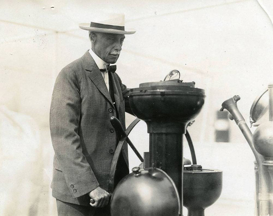
(Photo: Hagley Museum and Library)
source: images.marinelink.com
The gyrocompass is a device with movable spherical axes. On the inside, the compass is filled with liquid, in which there is a movable floating gyroscope. The gyrocompass operates based on the principle of shifting its center of gravity relative to the four cardinal directions. When determining the correct direction for the ship,, the gyroscope remains fixed motionless, while the ship’s course is calculated according to the available tabular values.
The ship gyrocompass was also equipped with a deviation compensator. Compasses have a natural magnetic error due to the fact that magnetic north is not totally aligned with true north. This problem is solved by adjusting for the latitude and longitude at which the ship is currently located.
Radio waves revolutionize navigation
The discovery of the properties of radio waves in 1895 made physicists consider the possibility of using them in the field of dynamic navigation.
One such physicist was Scottish-born Robert Watson-Watt. In 1935, he presented the world with his first practical radar system, which worked on the principle of sending, reflecting, and receiving radio waves. The system was able not only to detect the presence of an object in his study area, but also provided data on the distance between the object and the wave emitter, as well as its speed direction.
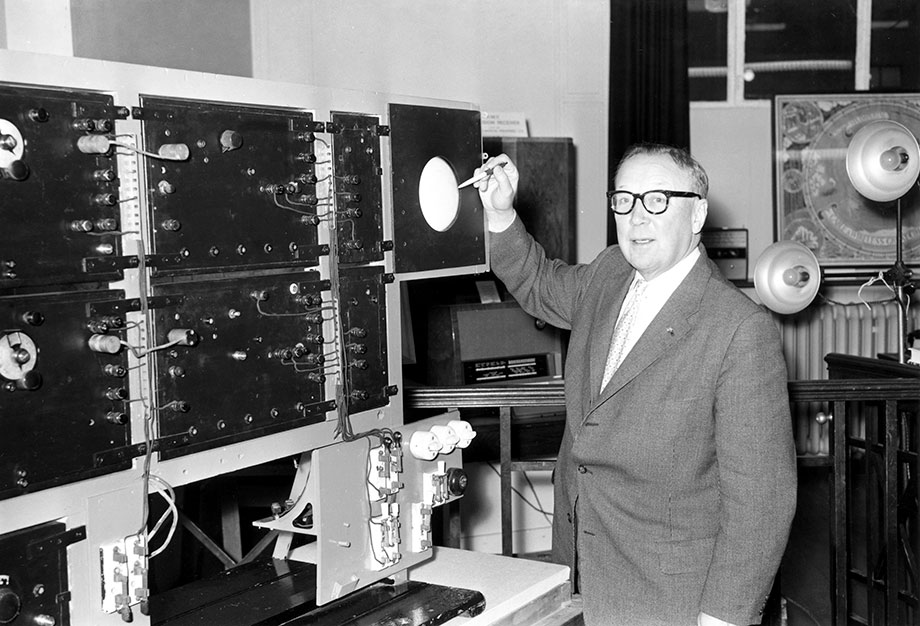
(Image credit: Science Museum / SSPL)
source: blog.sciencemuseum.org.uk
The next step in the development of radar systems was LORAN (Long Range Navigation), designed in the United States between 1940 and 1943. LORAN is a hyperbolic navigation system which uses two radar stations: a transmitting station and a receiving station. The pulse signal from the master and slave stations is received by a receiver located on board the ship. After that, the difference in the delay of the two signals is displayed on the cathode ray tube (CRT) of the information display. The indication of light pulses on the surface of the CRT display made it possible to understand the distance to the object, as well as to determine its size and direction. The accuracy of LORAN ranged from 100 meters to one kilometer.
LORAN was used successfully in the second half of the 20th century on ships and submarines, but had a very limited coverage area, which in turn affected its accuracy. The navigation systems were phased out towards the end of the century, when global satellite navigation systems became widespread.
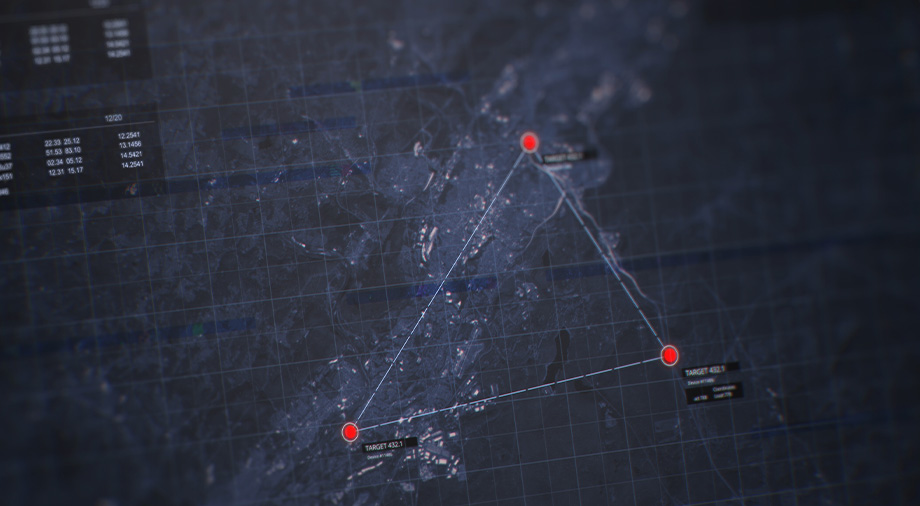
Satellite navigation: GPS and GLONASS
The development of space in the 20th century played a key role in the building of global navigation systems today. Understanding the basics of the Doppler effect helped scientists determine the vector of motion of an object in relation to the observer. It is this principle which formed the basis for today’s satellite navigation systems.
1973 marked the start of the development of GPS (Global Positioning System) by the US Department of Defense. The system uses constellations of satellites to determine the location of objects on the Earth’s surface. The system began operation in 1978, when the first eleven satellites were launched into orbit.
Signals sent from GPS satellites arrive at receivers stations located on Earth, giving a real-time, complete navigation picture by providing constantly updated information about the movement of the receiver and its geographical coordinates. GPS, like LORAN, works by measuring time differences between the signals arriving at the receiving station from different satellites.
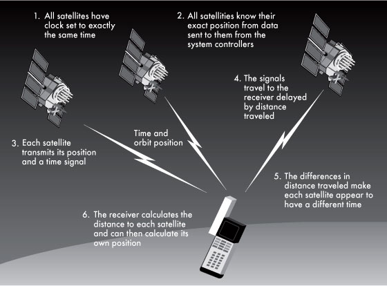
source: mason.gmu.edu
The more satellites involved in this process, the more accurately GPS works. At the moment, the GPS constellation consists of 24 satellites, which allows devices to calculate their location on the Earth’s surface within 10 meters.
It is worth noting that GPS is only one of the satellite navigation systems out there. Similar global navigation systems are operated by Russia (GLONASS), China (BeiDou), and the EU (Galileo).
With the advent of smartphones, the widespread use of global satellite navigation systems has skyrocketed. Modern smartphones can work with several satellite systems at once, which allows their users to freely travel around the world. Currently, most satellite positioning systems have moved from the government and defense sectors to the private sector.
Quantum accelerometry and what lies ahead for navigation tech
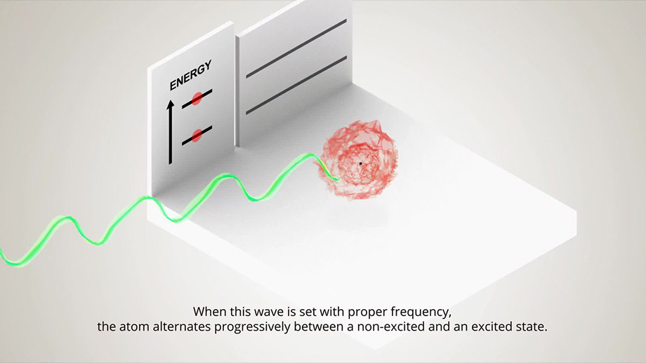
At the heart of the innovative technology of orientation by quantum gyroscopes and accelerometers is the process of atomic interferometry. This phenomenon is achieved by cooling atoms of matter to a state that is just above the state of absolute zero temperature (the minimum temperature that matter in the universe can have).
When ultra-cooled atoms are exposed to photon beams (laser light), they can achieve a state of superposition, a special property of particles in which they acquire two spatial coordinates at once: both moving and static (taking the properties of a wave function, while remaining in the state of a particle).
source: en.wikipedia.org
In engineering terms, this opens up the potential of creating an autonomous navigation system that can instantly receive information about a change in the position of an object (or an array of objects) in space. In other words, the topographic state of the landscape will be dynamic in the full sense of the term, and display the entire PTN (Position, Timing & Navigation) picture of objects located in the coverage area in real time.
This technology has the potential to become an alternative to GPS, since it lacks GPS’s main disadvantage – the delay caused by the time it takes for the signal to reach Earth from orbit and back.
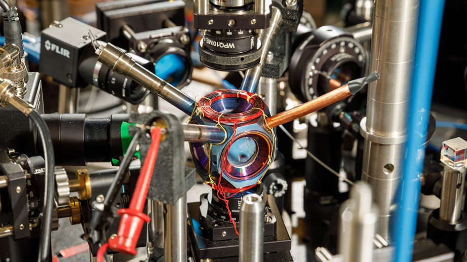
Today, the main experiments in the field of inertial quantum navigation systems are being carried out at the Sandia National Laboratory. The quantum sensor, created by a top team of scientists, has already been operating smoothly for more than a year and a half, and is showing amazing results in predicting landscape topology and navigating objects on it. This technology can presumably be used in drone navigation systems, as well as in areas where maintaining a constant GPS signal is critical (like civil aviation and shipping).
A group of scientists at Imperial College London has also managed to create their own prototype of a quantum accelerometer. They are also considering the possibilities of gravitational mapping, in which, according to a similar principle of quantum interferometry, the soil of the earth can be scanned, and then a search for minerals and other minerals will be carried out by creating interactive 3D maps of resource deposits.
(Photo by Bret Latter)
source: sites.breakingmedia.com
Whatever new navigation solutions appear in the future, the analog and manual methods of orientation and navigation which humanity relied on for millennia have been left decidedly in the past. Global satellite navigation systems operate on every smartphone, show us how to get where we’re going autonomously, and do not require users to understand anything about the technologies involved in the process. Quantum mapping technologies promise to bring even more confusion, at the same time, revolutionizing the accuracy of navigation systems.